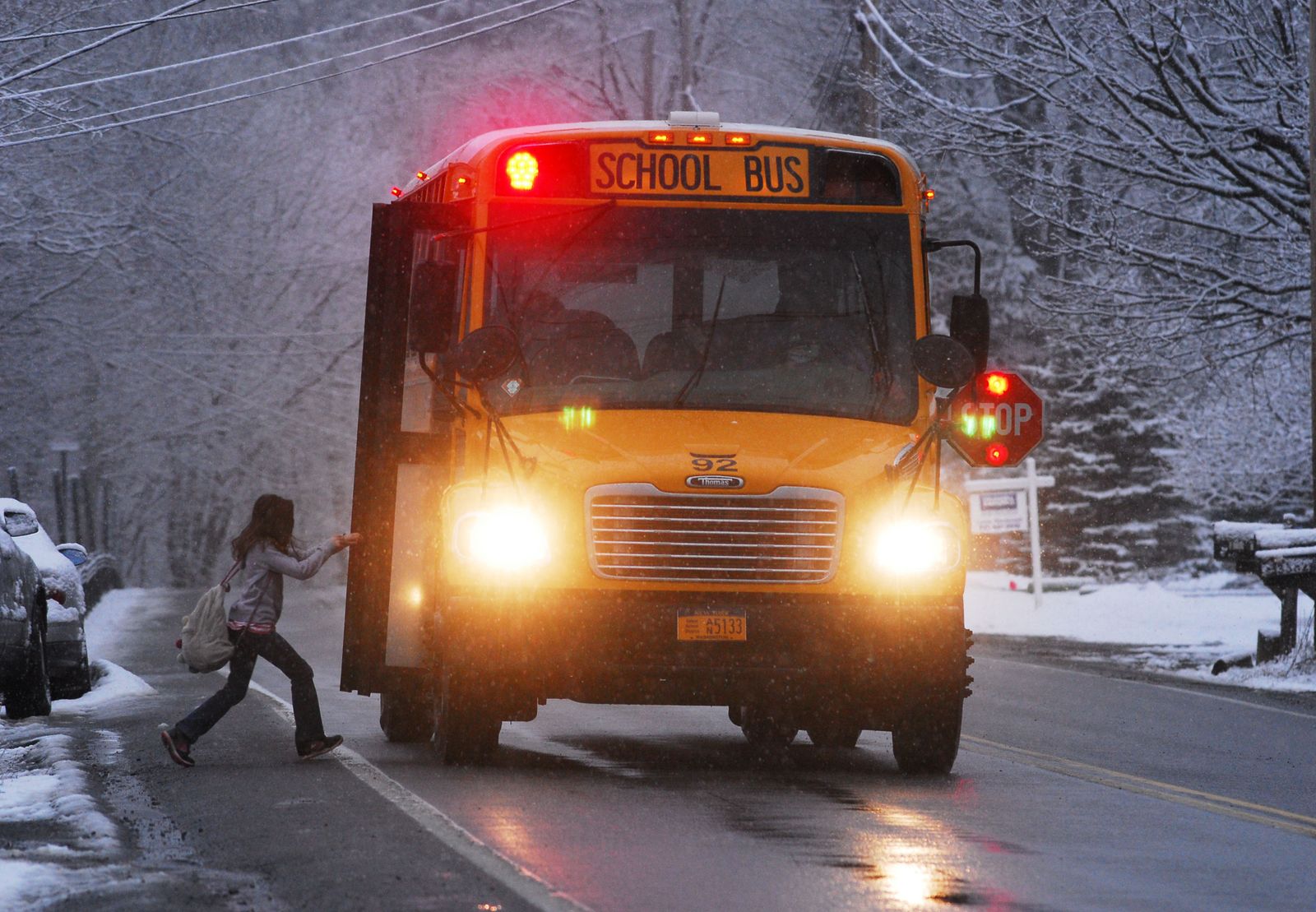
In October 2026 the district proposed new bus routes for every Amherst-area school (“version 1”). After more than 600 survey responses and a series of listening sessions, the district released second drafts on November 3–4, with two rounds of family feedback before a tentative launch on November 30. Current routes stay in place until then. Our comparison of the second draft with today’s routes is below. This site also tracks what the district has said, the open questions for the next version, and how to take part. Our stop-by-stop analysis of version 1 is at the bottom of the page.
We’ll search every statement and document we have, from the district’s routes and schedules to the listening sessions, School Committee meetings and our stop-by-stop analysis, and answer with sources.
Answers are generated automatically by AI (Anthropic’s Claude) from the public statements and documents collected on this site. AI models can be wrong, incomplete or out of date, and sometimes state things confidently that aren’t true (“hallucinate”); a citation shows what an answer drew on, not that the answer is correct. Answers are not reviewed by a person before they appear, are not official information from Amherst-Pelham Regional Public Schools, and are not legal, safety or professional advice. This site and the parents who run it make no guarantee about the answers and are not responsible for any decision made based on them. Always confirm stops, times and eligibility with the district at transportation@arps.org.
Questions are screened for topic and logged privately so we can improve the answers.
At three listening sessions the superintendent, the transportation manager and the operations team explained version 1, the constraints behind it, and what they plan to change, and families gave feedback. The third, on October 20, was an Amherst School Committee meeting, and transportation came up again that evening at the Regional School Committee. Paraphrased.
Every family is asked to review their child’s proposed route and stop at arps.org/bus-routes. The routes are still proposals; current routes stay in place until the tentative November 30 launch. Our comparison with today’s routes →
The district’s feedback form closes Tuesday, November 10, at 6:00 p.m. The district asks families to use it even if they also attend a listening session or ride-along, so concerns are tracked in one place.
Stops closer to home where walking was a concern (Flat Hills, High Point, Market Hill, Leverett and East Leverett Roads, Harkness Rd, Hulst Rd, West Pomeroy Ln); right-side pickups along South East St; more stops inside High Point, Rolling Green and Riverglade; stops for Dennis Dr and Harkness Rd; corrected Henry St addresses and clearer stop names; and regrouped routes in Amherst Woods and Bay Rd / Country Corners.
Can you find your child’s route and stop? Are the pickup and drop-off locations clear? Are there walking or crossing concerns still to review? Is any student or location information missing or wrong?
Residential stops for kindergartners, the safety review of busy roads, walking access and crossings (including the 2015 Amherst walkability study), input from UMass transportation experts, listening sessions and ride-alongs, and prompt delay notices.
Zoom sessions: Wednesday, November 4, 4:00–5:30 p.m.; Thursday, November 5, 6:00–7:00 p.m.; and Thursday, November 12, 5:30–6:30 p.m. Ride-alongs on four routes run November 4–5 (sign-up closed November 3).
The ride-alongs pair each elementary line with a middle/high route on the same bus: Yellow with Amherst 3, Green with Amherst 8, Red with Amherst 9, and Crocodile with Amherst 10.
A Committee member read from the bus contract: 18 buses for Amherst elementary and 18 for middle and high school, the same buses running both tiers. Version 1 posts 10 routes for each. Four of the buses are driven by district staff and 14 by the bus company. The superintendent said some routes may end up with more than one bus.
A bus that runs both the elementary and the middle/high run costs the same as one that runs a single run, so the number of buses drives the cost.
The district says lawyers have reviewed the contract since the summer, the company has had written feedback on its performance, and other companies asked to help are also short of drivers.
The superintendent said the number of stops will go up from 235: kindergarten home pickup, walks found to be unsafe, neighborhoods that were missed, and students who stayed at their school after redistricting.
About 300 addresses didn’t transfer correctly into the routing software. In one case Harkness Rd was misspelled there, so none of its riders showed up on the routes.
Get clean, matched address data before anything else goes to families. Plan for dark winter mornings and fast rural roads. Hire more district drivers with signing bonuses, better pay and free license training (district drivers are unionized, so this needs negotiation). Look at how the elementary and middle/high runs fit together, and make transportation its own agenda item.
The district found about 300 mismatches between its student and routing systems and is fixing them with IT and the registrars. This is a big part of why some neighborhoods looked empty in version 1.
District drivers have test-driven the proposed routes, and the bus company’s dry runs started Oct 20. The 235-stop count is going up as the routes are edited.
The district met with the UMass Transportation Center (UMTC), which committed to supporting the work, and is using the 2015 Amherst walkability study.
Routes were adjusted for Hitchcock Center after-school drop-offs. Families with other after-school stops should tell the district.
Oct 20 was run as a School Committee meeting with public comment, so the district didn’t answer questions live. It will schedule more question-and-answer sessions, and the FAQ, including questions from this meeting, is due Oct 21–22.
Hold the bus company to its contract. Buses are already full, so fewer buses may not fit everyone. Walks along Route 63, West St near the rotary and busy apartment entrances aren’t safe. Pickups before 7:20 are too early for young children. Families want same-day notice when buses are combined, a clear answer for students who stayed at their school after redistricting, and help from the schools asking the town for Safe Routes to School sidewalks.
The published times are estimates with buffer built in. The district heard that the early pickups don’t work for families and will move them later in the next version. Families will still need to be at the stop on time, because waiting at stops makes whole routes late.
When a regular stop is snowed in, there will be designated alternate “snow stops.” Students can use any stop on their own line, and each stop keeps the same number in the afternoon.
Harkness Rd stops, left off by accident, will be back. Stops will be added on Pine St if the survey shows riders there. Market Hill Rd and E Leverett Rd are being revisited. Crocker Farm students living in the Amethyst Brook zone will get a route, and new routes try to avoid transfer buses.
Kindergartners keep home pickup, the district is considering the same for first grade, and younger grades may get more stops than older ones. The review is using the Amherst walkability study and maps sent in by families.
Pickups are planned on the door side of the road. On busy roads like N Pleasant St, the district will look at running afternoon routes in the same order as mornings, so children aren’t dropped across the street. That also evens out ride times.
Version 1 covered routes within Amherst. Routes in the other towns will mostly stay as they are, so if your child is picked up there now, expect that to continue. If you found no stop for your child, email the transportation manager.
Some records hold a mailing address, such as a post office box, instead of where the child lives, which puts them in the wrong place for routing. The district is cross-checking with its registrars, and the survey now emails you a receipt and a copy of your answers.
At the middle and high schools, late arrivals caused by the bus are excused and tracked separately. Elementary instruction starts at 8:20, with tardy at 8:25, to absorb late buses. School start times are not changing.
Elementary buses seat three per seat (71–77 riders); middle and high school buses about 47. Routes are planned to about three-quarters full, and a second bus can run the same route if more riders sign up.
The FAQ is now due Thursday, Oct 22, and revised routes come out Nov 2–9 with a new feedback period. The full timeline is in How to share feedback.
The bus provider began the year about 10 drivers short and is now 5–6 short, with no firm date for when that ends. Today’s routes were built for a larger workforce, which is why buses are sometimes doubled or tripled up. The district hasn’t yet published how many buses or drivers a new plan needs.
The 7:48 arrival includes buffer time; the target arrival is still 8:10 (9:00 for middle/high). The old routes had about 15 minutes of buffer and still often ran late, so version 1 adds about 12 more. The earliest pickups are worst cases, and times will be adjusted after dry runs with the bus company. Until then, families should plan around the published pickups.
District numbers: buses average 8:25 at Amethyst Brook and Crocker Farm (8:10 start), and 9:21–9:24 at ARMS and the high school (9:00 start). 52.5% of Crocker Farm’s morning arrivals were late between Aug 31 and Oct 9. Getting children to school on time is the main reason for the redesign.
Routes are built in Traversa from the student addresses in PowerSchool. Addresses with typos or in new developments may not plot, and second households and after-school addresses aren’t in the system, so some neighborhoods can look empty to the routing software. The district is asking families to confirm addresses through its survey.
Version 1 was drawn from each school’s zone map, so students who stayed at their school after redistricting, such as about 10 Crocker Farm students near the Amherst College stadium, had no route. The district said it will add them.
Version 1 goes from more than 600 stops to 235 and keeps buses off neighborhood roads to reduce snow problems and breakdowns. The tradeoff is more walking along and across main roads such as Station Rd, S East St, Market Hill Rd and Pomeroy Ln, some without sidewalks or crosswalks. The district has committed to re-checking walking conditions.
IEP/504 riders aren’t on the published maps; the district plans their transportation one on one. Parents asked how longer rides would affect students who manage a short ride well but may struggle with a much longer one.
Version 1 covered routes within Amherst. For High Point / Flat Hills, which had no version 1 stop (the nearest middle/high stop was 1.7 miles away), the district plans a pickup at the end of a Shutesbury route. The Leverett, Shutesbury and Pelham routes haven’t been published yet.
Drivers, including the substitutes covering for the shortage, need to know new routes and standing detours. On Crocker Farm 19, where Potwine Ln is impassable, the district will set up a temporary route and talk with the bus company about detours and closures.
Home pickup for kindergartners. Re-checking sidewalks and walking conditions at proposed stops. Specific fixes for the stadium area, Hillcrest/Memorial/Jeffrey, High Point / Flat Hills, Pomeroy Ln and Potwine Ln. An FAQ on Monday. And, from the superintendent, openness to extending the survey and the rollout and to letting families review revised routes before they start.
The district says it will schedule more question-and-answer sessions. How to take part →
The district posted second drafts for every Amethyst Brook and Crocker Farm line and every Amherst middle/high route (arps.org/bus-routes). We compared them with today’s routes the same way we compared version 1: every stop on the district’s run sheets for today’s morning buses, matched to the nearest second-draft stop on that school’s lines by walking distance. Version 1’s figure is shown with each number for context. These are proposals, and the times are the district’s published estimates. The district’s feedback form closes Tuesday, November 10, at 6:00 p.m.
| Line | First pickup | Arrives | Longest AM ride | Longest PM ride | Longest day | PM order |
|---|
Morning rides run from each stop’s scheduled pickup to the school arrival; afternoon rides from dismissal (2:35 elementary, 2:40 middle/high) to the scheduled drop-off. Longest day: the stop with the most morning plus afternoon minutes. “Same order”: the afternoon run drops off in the order the morning run picks up.
Filled circles are today’s stops, sized by riders and colored by the second-draft line they’d use (black: no second-draft stop within a mile). White circles are second-draft stops, labeled with the district’s AM / PM stop numbers. Dashed lines are the walks to the nearest second-draft stop. We drew the line paths along the streets between the published stops; the district hasn’t posted second-draft maps. “Watch the morning run” replays the line in about a minute, with a short pause at each stop; the clock shows the district’s scheduled times.
Today’s routes: the district’s morning run sheets dated September 18 (18 elementary and 18 Amherst middle/high buses, with kids per stop). Second draft: the Round 2 tables on the district’s route pages, as posted November 4. Each of today’s stops is matched to the second-draft stop on its school’s lines with the shortest walk along the streets. Walks are stop to stop, since home addresses aren’t public, at 2.5 mph for elementary and 3 mph for older kids. Time on the bus runs from the scheduled pickup to the school arrival. Riders with no second-draft stop within a mile, and 25 middle/high riders in Leverett and Shutesbury, are counted separately and left out of the averages. Sidewalks: the Town of Amherst’s sidewalk map along each walk. Middle/high riders can also use the Amherst stops of the Leverett/Shutesbury and Pelham buses (routes 25, 35 and 38), which the district posted separately and didn’t change: E Leverett Rd, Bridge St, Shutesbury Rd, Pelham Rd and Jenks St. After-school stops (Hampshire Athletic Club, Hampshire Gymnastics, the Hitchcock Center) aren’t used as neighborhood stops. Stop locations come from town address points and OpenStreetMap and may be off by a few houses.
Questions families have raised for the next version of the routes, with the district’s answers so far. Compiled from parent emails and submissions, our analysis of version 1, and the district’s listening sessions. We update each one as answers come in.
Have a question that isn’t here? Bring it to a listening session or email transportation@arps.org.
Questions, ideas, what your mornings look like. No sign-in: pick a nickname and post. Vote up what matters most.
Loading…
The district’s survey closed October 23 with more than 640 responses. Current routes stay in place while the district revises the proposal, and second drafts are posted at arps.org/bus-routes for the first of two more rounds of feedback:
See the open questions → Bring one to a listening session.
The district builds routes from the addresses in its own system. Kids added after school started, new addresses, typos and second households can all be missing, and then a neighborhood can look like it has no riders. Only the district can update its records, so let them know.
Shared with us by parents. We’ve paraphrased and trimmed what parents wrote and removed names and addresses. Every family that sent us a route sheet said they’re considering driving instead.
There’s no sidewalk, and there’s a blind curve. If this sticks, we’ll probably end up driving. The new route goes right past our old pickup spot. They could just stop on the way by.
Our analysis agrees: on Bus 11, the Grey line passes 4 of the old stops whose kids now walk with no sidewalk.
Our afternoon drop-off moved from 2:49 to 3:17. Add the earlier morning pickup, and our kindergartner is on the bus more than an extra hour a day.
Bus 6’s kids average 16 more minutes on the bus every morning. We don’t have afternoon run sheets yet.
I honestly can’t tell if we’re still on a bus route. School is a 21-minute walk, the nearest stop is 9 minutes away, and some of the streets in between have no sidewalks. Are we supposed to walk to the stop, or all the way to school?
Our family, and another family at our stop, were never on any of the original route documents because we didn’t have an official assignment when school started. Nobody updated the documents, so the new routes may not count our kids at all. Our new stop on the Orange line is an 11-minute walk, possibly through the traffic circle by the campus entrance.
We checked: the district’s Bus 12 run sheet has no E Pleasant St stop, so these kids aren’t in our Bus 12 numbers either. If your kids are in the same spot, tell the district.
Our whole middle/high school route is just gone. It used to pick up about 40 kids around Market Hill, Flat Hills, Overlook and High Point. Now the closest stop is a 36-minute walk with no sidewalk the entire way, and no crosswalk where we’d have to cross.
Our analysis agrees: on the Sept 18 run sheet, 23 of old Bus 12’s 43 riders (upper Flat Hills Rd, Overlook Dr and High Point Dr) have no stop on the district’s new middle/high routes within a mile.
Our son goes to the middle school, and we can’t find his stop, or anything near it, on any of the new routes. Walking to school would be about two miles. We both work, and we won’t have him walking that far each way in the middle of winter.
We checked: their old stop, S Pleasant St at Hillcrest Pl, had 3 riders on the Sept 18 run sheet. The nearest stop on the district’s new middle/high routes is 0.9 miles away on foot. If those kids make that walk, pickup moves from 8:49 to 8:24, and time on the bus goes from 6 minutes to 24.
Our whole neighborhood next to the Amherst College stadium has no Crocker Farm stop, even though two buses run down South Pleasant Street toward Crocker Farm.
We checked: the Turtle and Frog lines both drive S Pleasant St about 400 feet from the old Walnut St & Woodside Ave stop and don’t stop. The run sheet shows 5 kids at the two Woodside Ave stops. Their nearest new stop is 8 Hillcrest Pl, a 14–17 minute walk.
There will be no bus for my two kids.
We checked: the run sheet shows 2 kids at Dana St & Dana Pl. No stop on Crocker Farm’s new lines is within a mile; the nearest is 8 Hillcrest Pl, about 25 minutes away on foot.
Paraphrased from a parents’ email thread, Oct 14–15. Names and contact details removed.
They dropped our street from the route completely. There’s no safe way to walk to school from here. We’ve asked the Town Council for years for a crosswalk or a sidewalk.
Why would our kids get to school 20 minutes earlier than they’re picked up today? Nobody has said the school day is starting earlier, and changing the start time would take a School Committee vote.
Standing at the bus stop right now: does anyone actually know when the new routes start? Is it the 23rd? Later?
Since then: the launch is tentatively Monday, November 30, after two more feedback periods. Current routes stay in place until then.
The new route drives right past my son’s current stop on the way to his “new” one, and again on the way back. Plenty of kids get on at that stop. Why make them walk 10 minutes when the bus already goes by twice?
We see this across the district: on 11 of the 18 old elementary buses, and 10 of the 18 middle/high buses, the new route passes at least one old stop whose kids now walk with no sidewalk. Pick a bus above and check “New line passes the old stop?”
The district is revising these routes, so treat this section as the record of what was proposed: every old bus compared with version 1, using the district’s run sheets, schedules and the town’s sidewalk map.
The district hasn’t published the new middle/high schedules the way it did the elementary lines. Their stops and times come from the district’s Stop Rationale Log, which for the elementary lines ran about 7 minutes later than the published schedules. 25 riders who live in Leverett and Shutesbury aren’t compared: the log only covers Amherst routes.
All ten new elementary lines, drawn along the roads in the district’s published stop order and checked line by line against the district’s own route maps. Turn on the old buses (both schools) to compare. Pick a line or bus to see its stops; for an old bus, you’ll see where each stop’s kids go now.
New schedules: arps.org Amethyst Brook and Crocker Farm bus route pages. New lines are drawn with OpenStreetMap routing and checked against each line’s published district map. Old buses: the district’s Amethyst Brook and Crocker Farm AM run sheets. The district never published maps of the old routes, so they’re drawn stop to stop along the shortest roads and may differ from the exact roads driven.
Each stop on each old run sheet at both schools, matched to the nearest new stop on its school’s lines by street walking distance and weighted by the number of kids the sheet shows getting on there. The whole district gets up earlier. Counting the extra walk to the new stop, more than half of the old buses’ kids (328 of 611) also have a longer trip to school.
Average minutes for each old bus’s riders: the bus ride, plus the extra walk to the new stop (the dashed end of each bar). Thicker bars mean more kids.
Click a bus to open its before-and-after map. Walks are measured stop to stop along the streets at a child’s pace (2.5 mph); home addresses aren’t on the run sheets. 9 kids whose old stop is closer to the school than to any new stop are left out of the averages, since they may now be expected to walk. So are the 25 kids with no stop on their school’s new lines within a mile.
We checked every kid’s new walk, from the old stop to the new one along the streets, against two independent records: the Town of Amherst’s sidewalk map and MassDOT’s 2025 Road Inventory.
children 14 and under were killed as pedestrians in U.S. traffic crashes from 2021 through 2024: 176, 188, 171 and 172 a year.
The new routes put 409 Amherst kids at the curb earlier, some of them in the dark, and send dozens walking along roads with no sidewalk. That’s why walking conditions at each stop matter.
Sources: NHTSA, Children: 2024 Data, 2023, 2022 and 2021 (FARS; “children” = 14 and under); NHTSA, School-Transportation-Related Traffic Crashes: 2015–2024 Data (school-age = 18 and under); Education Week, Oct. 2026. No federal source counts walks to school specifically, and 2025 federal data hasn’t been published yet.
Ordered by total kid-miles without a sidewalk. Click a bus number to see its map; the no-sidewalk parts of each walk are marked with pink dots.
Each walk is sampled about every 30 feet. Town of Amherst: a sample counts as having a sidewalk if a mapped sidewalk centerline (Amherst GIS, “Sidewalk Centerlines”, crosswalks excluded) is within about 60 feet. We tested that rule on known streets first: Wildflower Dr 95%, downtown Main St 74%, downtown S Pleasant St 161% (sidewalks on both sides), Station Rd 10%. MassDOT: each sample is matched to the nearest Road Inventory 2025 segment within about 50 feet and counts as having a sidewalk if the left or right sidewalk width is above 0 ft. Some streets are missing from MassDOT’s layer. Walks run stop to stop because home addresses aren’t on the run sheets, so a child’s full walk is usually longer. Kids whose old stop is closer to the school than to any new stop aren’t included. Neither data source records sidewalk condition or snow clearing.
Pick an old bus (elementary or middle/high), then step through the map: 1 Before shows the old route, 2 After shows the new line(s) those kids ride now, and 3 The walk shows how far each stop’s kids now walk to the new stop, with the stretches that have no sidewalk in pink. Buses are ordered from biggest increase in trip time (bus + walk) to smallest.
Each row is an old stop. The orange dot is how long those kids used to ride; the blue dot is their new ride plus the extra walk to the new stop (the dashed end of the bar). A red bar means a longer trip, green a shorter one. Thicker bars mean more kids.
Method: each old stop is matched to the nearest stop on its school’s new lines by street walking distance (OpenStreetMap), walked at 2.5 mph (child pace; 3 mph for middle/high). If none is within a mile, the stop is listed as having no new stop within a mile. Time on bus = school arrival minus pickup time; old arrival 8:10 (run sheets), new arrival 7:48 (published lines). Totals are weighted by the number of kids at each stop. Home addresses are unknown, so the walk is measured old stop → new stop. House-number stops are shown by street only.
All ten new elementary lines, at both Amethyst Brook and Crocker Farm, are scheduled to pull in at exactly 7:48. Under the old route, Bus 6 pulled up to Amethyst Brook at 8:10. Its kids didn’t get a shorter ride for the earlier arrival. They got a longer one that starts 38 minutes earlier and ends 22 minutes earlier.
From the first pickup to arrival at school. The bar starts when the first child gets on.
Thirty-two of Bus 6’s 45 kids now board between 7:14 and 7:19. Under the old route the same kids boarded between 7:57 and 8:05.
In December, that’s around sunrise. The district’s own FAQ says stops are designed for normal year-round conditions and that “routine winter weather by itself” won’t change a stop. Every Green line neighborhood stop is logged as “sidewalk status not yet confirmed.”
When a bus route gets worse, some parents start driving. The bus still runs either way, so every car is extra. How many families have to switch before our neighborhood’s drop-off traffic out-pollutes the entire bus?
families driving and the neighborhood’s car trips emit more CO₂ than the whole bus run.
kids leaving the bus and it becomes dirtier per rider than just driving them.
Estimates, not measurements. Diesel 10.18 kg CO₂/gal, gasoline 8.89 kg CO₂/gal (EPA). A car idles at about 0.3 gal/hr. Morning only; double it if afternoon pickups switch too. Green line distance from the district’s Route Review Summary. Adjust any number above.
Quotes are from the district’s Parent-Ready Stop Rationale Log (route summary, rationale codes and FAQ) released with the new routes.
“Framework target: ≤40 minutes”
The district’s own summary lists the Green line at 43 minutes, over its own target. The published Crocodile line runs 46 minutes, from 7:02 to 7:48. The first Bus 6 kids now ride 34 minutes; under the old route the longest ride was 22.
Stops selected because they “help control overall ride time.”
Bus 6 kids went from 555 to 1,283 kid-minutes on the bus every morning, +131%. Only 5 of 45 kids ride the same or less.
“The absence of a sidewalk alone does not automatically make a low-speed residential walking route unsafe.”
Every Green line neighborhood stop is logged as “sidewalk status not yet confirmed.” Bus 6 kids now walk an average of 3.4 extra minutes each way, up to 8.4, on roads whose sidewalks haven’t been confirmed yet.
A cluster stop is preferred over “door-to-door service when a reasonable cluster stop exists.”
Bus 6 already used cluster stops at intersections. The bigger change is the schedule: 38 minutes earlier, to arrive 22 minutes early.
“Routine winter weather by itself” doesn’t change a stop.
Moving pickups from ~8:00 to ~7:15 puts most of these kids at the curb around sunrise in December and January, on unconfirmed-sidewalk roads.
Most route and stop requirements are “determined at the State and local/district level.”
These are local choices, so they can be adjusted locally, including start and arrival times.
The log is titled a “Parent-Ready Stop Rationale Log.”
Its times differ from the published schedules: every elementary line runs about 7 minutes later in the log (up to 13 for Blue). Some route descriptions in its summary don’t match the stops listed.
“Framework target: … ≤18 student/neighborhood stops.”
Stop counts are within the target. The larger change is time: kids on 6 of 10 elementary lines are picked up before 7:20, and every line arrives at 7:48 no matter when it started.